The Cross Borders Drove Road
| FEATURES: | ||
| Distance: 52-70 Miles / 83-112 Km | Season: March to October | |
| Start: Hawick | Min Group Size: 1 | |
| Finish: W. Lothian / Edinburgh | Difficulty Rating: 2/3 | |
Overview
The Cross Borders Drove Road is one of the newest additions to an elite group of specially selected long distance walks, known as Scotland's Great Trails.
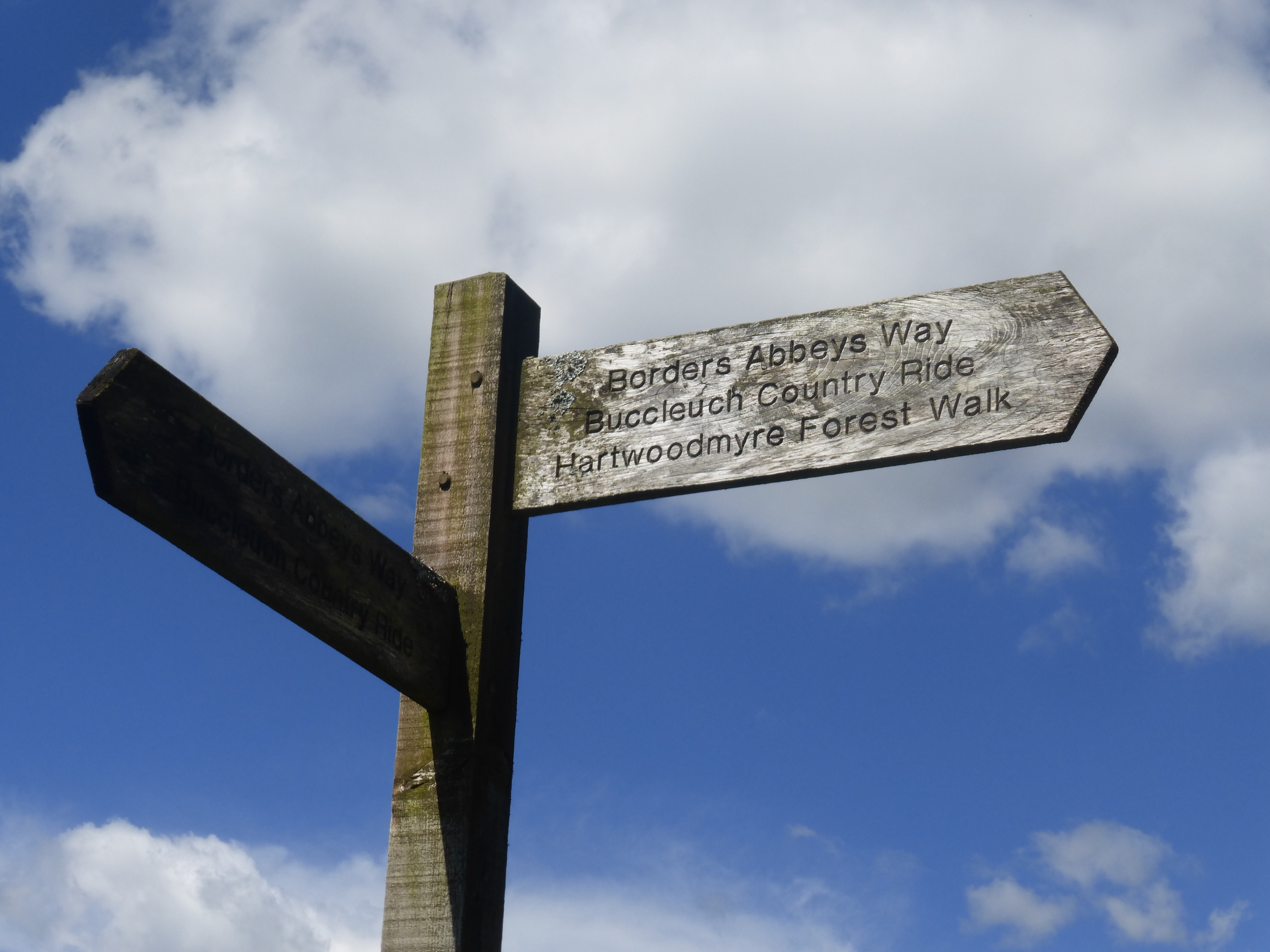
Starting in the bustling Borders town of Hawick, the trail meanders north towards Scotland's capital city of Edinburgh, through hidden valleys, beautiful countryside, rolling hills and historic villages. The route encounters a variety of established paths; used by walkers, cyclists and horse riders for years. The Drove Road uses existing trails such as The Borders Abbeys Way and The Southern Upland Way as it heads north. Local walking routes are also utilised, including Hawick Walks, the Tweed Trails and the South of Scotland Countryside Trails.
The route is well signposted, using a variety of way markings, although a map is essential for some sections on the trail.
The official Drove Road, from Hawick to Harperrig, is 52 miles long, however, this is extended to between 60 and 70 miles, depending on whether walkers wish to continue into West Lothian or Edinburgh.
A number of plaques and information boards can be found along the way, providing some excellent information on the history and wildlife of the region. From cattle markets and old drove roads, to the natural wildlife and rolling Borders hills, there is an abundance of interesting facts to learn.
WAS Holiday packages range from 3 days/4 nights to 5 days/6 nights, however, as with all our holidays, this can be tailored to specific client requests.
Start Location: Hawick
End Location: Harperrig/West Lothian/Edinburgh
Distance: 52 - 70 miles
Towns & Villages: Hawick, Selkirk, Innerleithen, Peebles, West Linton, East Calder, Livingston, Edinburgh
THE ROUTE
STAGE 1: HAWICK TO MIDDLESTEAD
DISTANCE: 10.80 MILES / 17.30 KM
HIGHEST POINT: 320 METRES
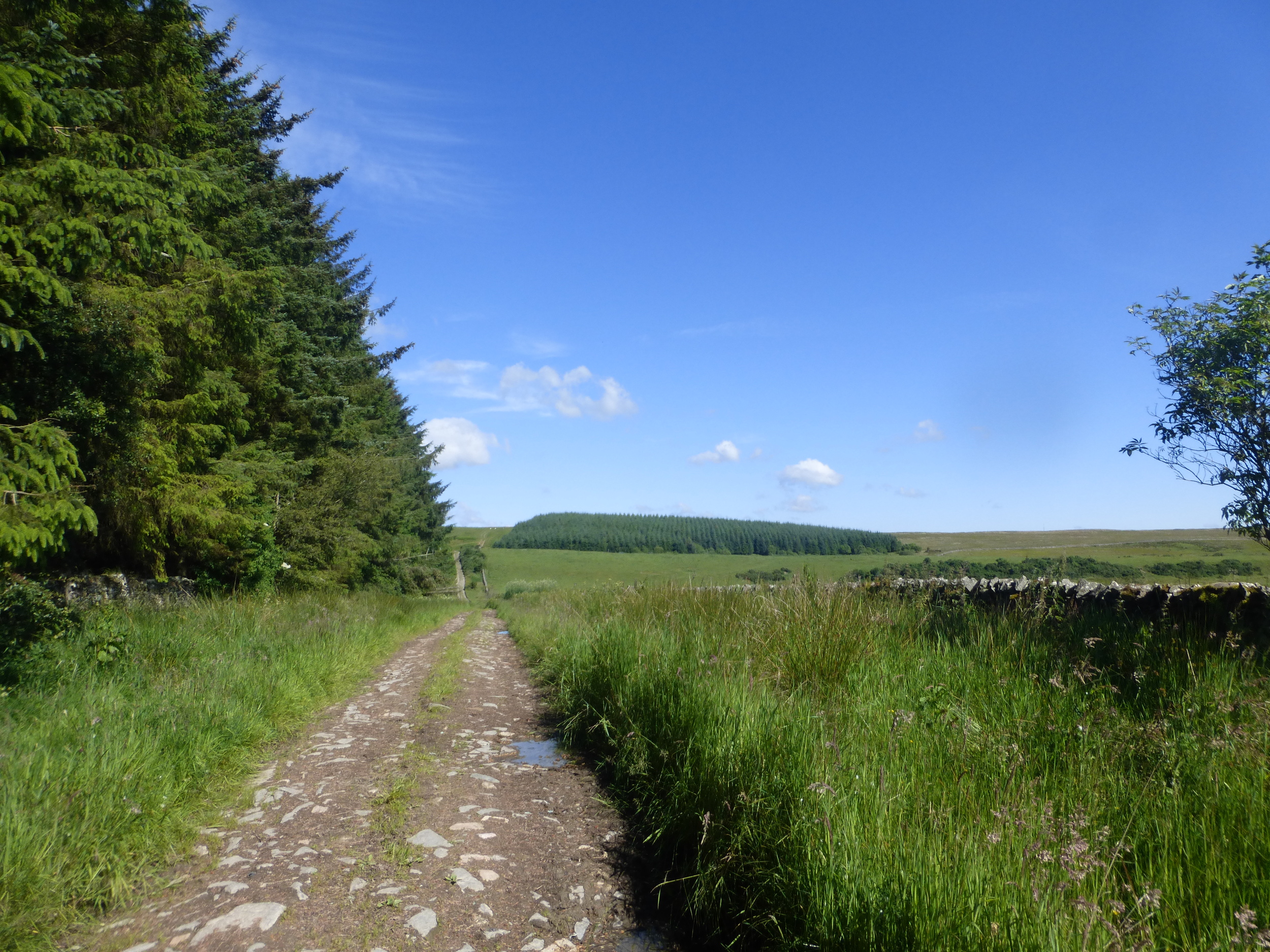
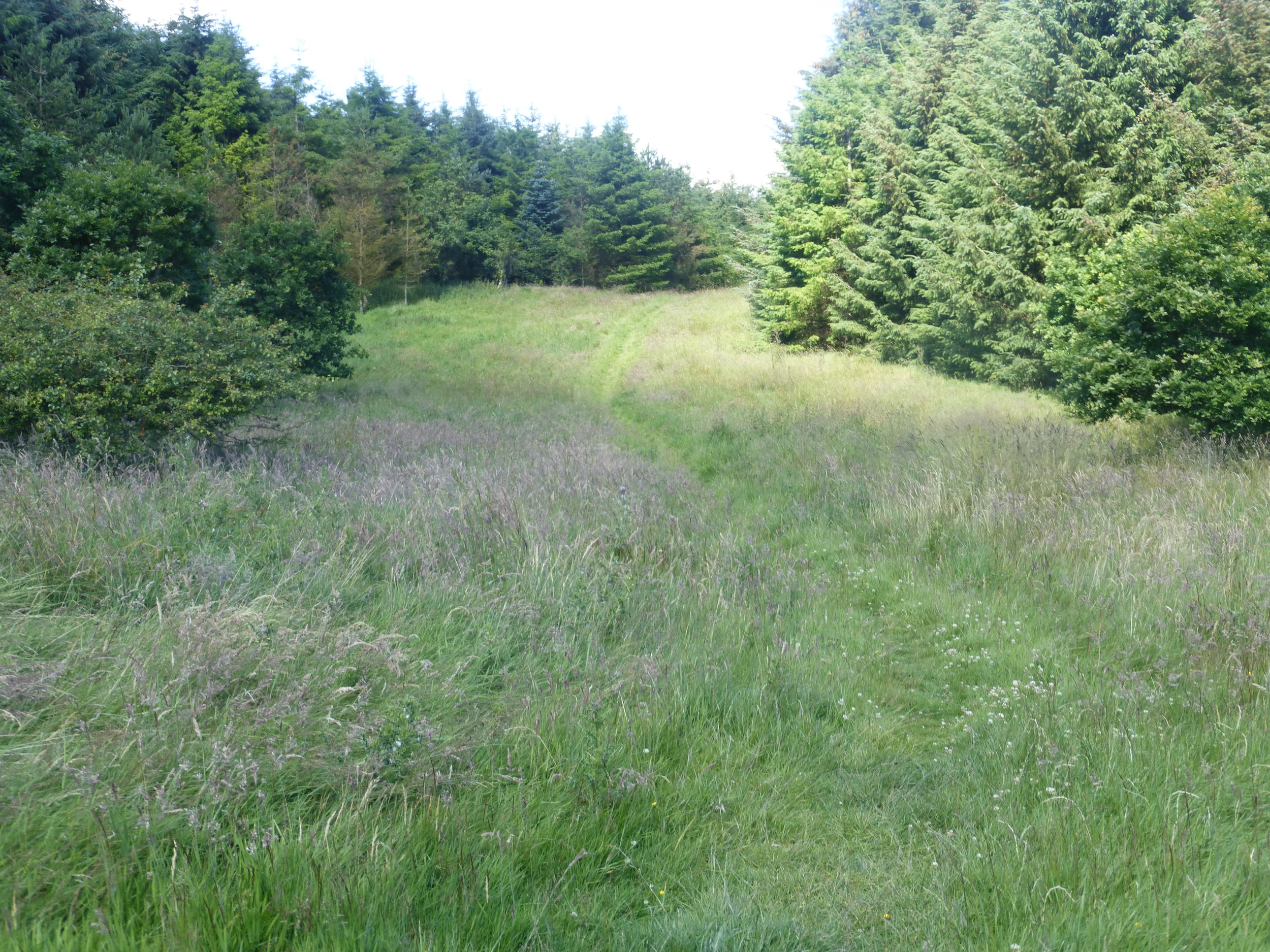
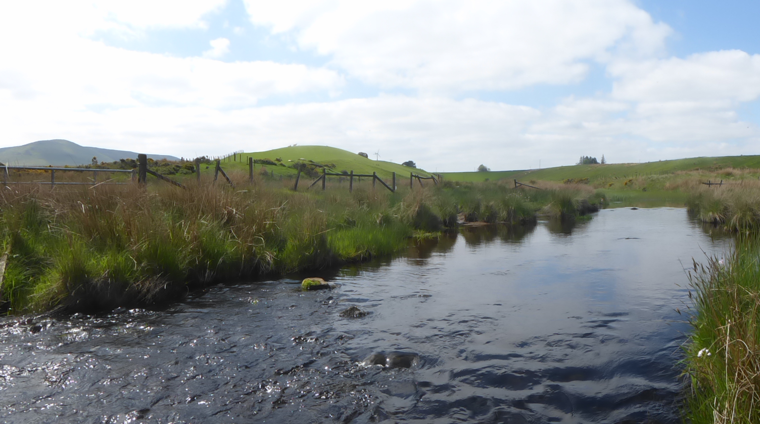
The trail begins at the bridge where the A7 road crosses the River Teviot (Grid Ref: NT 500 145). The route follows the river before joining a country road leading away from the town and into the hills. Once on the open hillside, the path follows an old drove road to Drinkhouse Hill (314 metres) where it joins the Borders Abbeys Way. After a lovely forest walk and a skip through Woll Golf Course, the trail follows a quiet country road to the Buccleuch Estates Woodlands. The stage ends at the Middlestead Farm, with a 1.9 mile walk or pre-arranged transfer into Selkirk.
STAGE 2: MIDDLESTEAD TO TRAQUAIR
DISTANCE: 9.8 MILES / 15.80 KM
HIGHEST POINT: 490 METRES
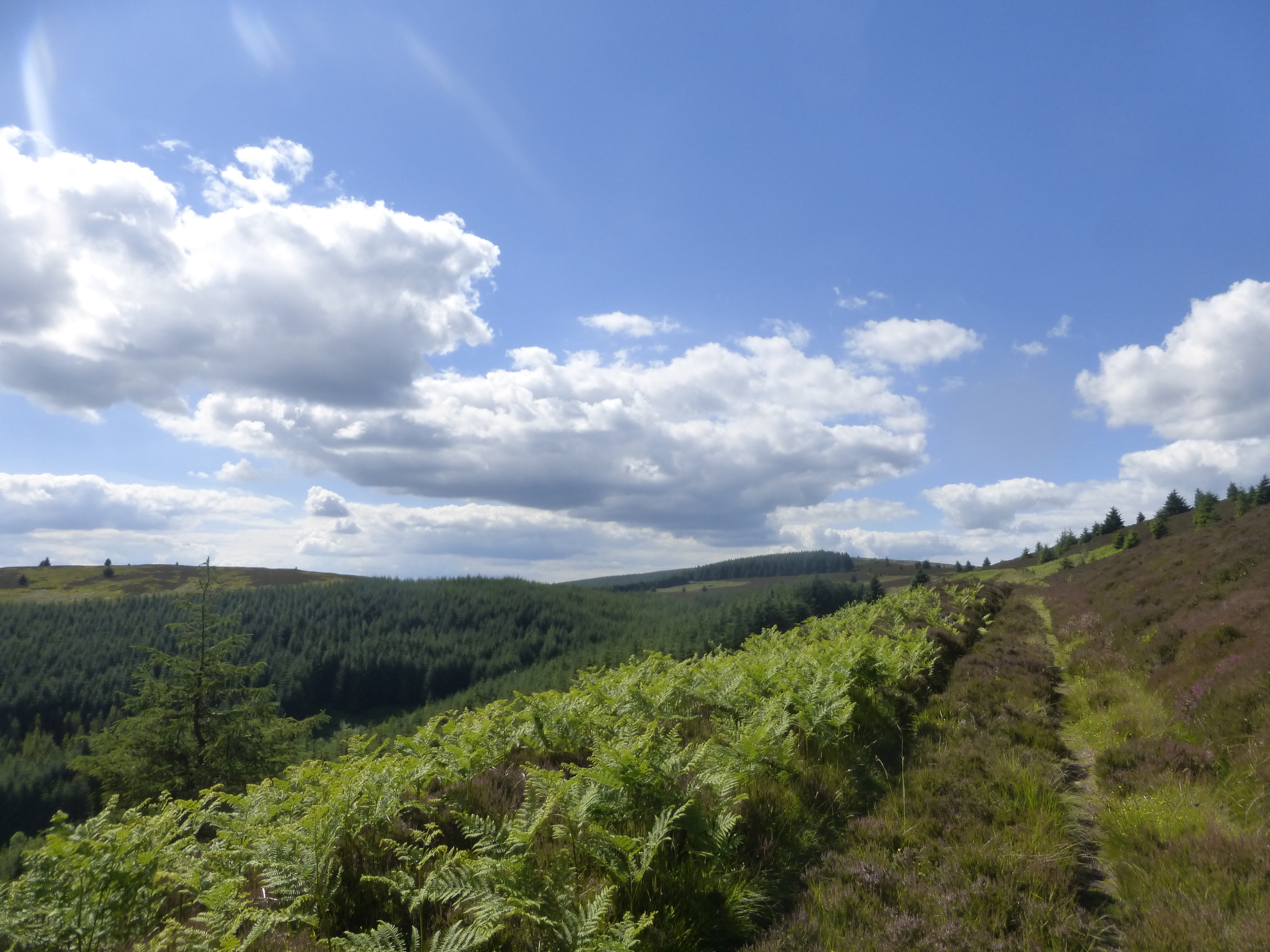
From Middlestead Farm, the trail follows a country road before diverting onto a track to Oakwood Mill Farm. After crossing the Ettrick Water, the route enters the forest which surrounds the Bowhill Country Estate. The route then follows a country road, passing Newark Castle on the way to the small village of Yarrowford. From here, the trail climbs back into the rolling hills and countryside, where a delightful path winds through carpets of heather and bracken where it joins the famous Southern Upland Way. Following the Way in a north westerly direction, reaching a height of nearly 500 metres, the views across the borders hills are fantastic. The descent into Traquair is gradual, allowing walkers to soak in the beautiful views all the way to the foot of the hill.
STAGE 3: TRAQUAIR TO PEEBLES
DISTANCE: 9 MILES / 14.5 KM
HIGHEST POINT: 434.5 METRES
Stage 3 starts with a gentle walk along two country roads (care must be taken) to The Glen Estate. The path climbs quickly, where a track (eventually becoming quite faint) leads directly up the hillside to the edge of some thick woodland. The path follows the perimeter of the woodland to the top of Kirkhope Law (537 metres), allowing for almost 360 degree views of the surrounding hills and distant mountains. The trail meets a wonderfully maintained drove road and descends gradually down into the town of Peebles through Gypsy Glen. From Traquair, the 'Cross Borders Drove Road' is very well signposted.
STAGE 4: PEEBLES TO WEST LINTON
DISTANCE: 12.88 MILES / 20.73 KM
HIGHEST POINT: 294 METRES
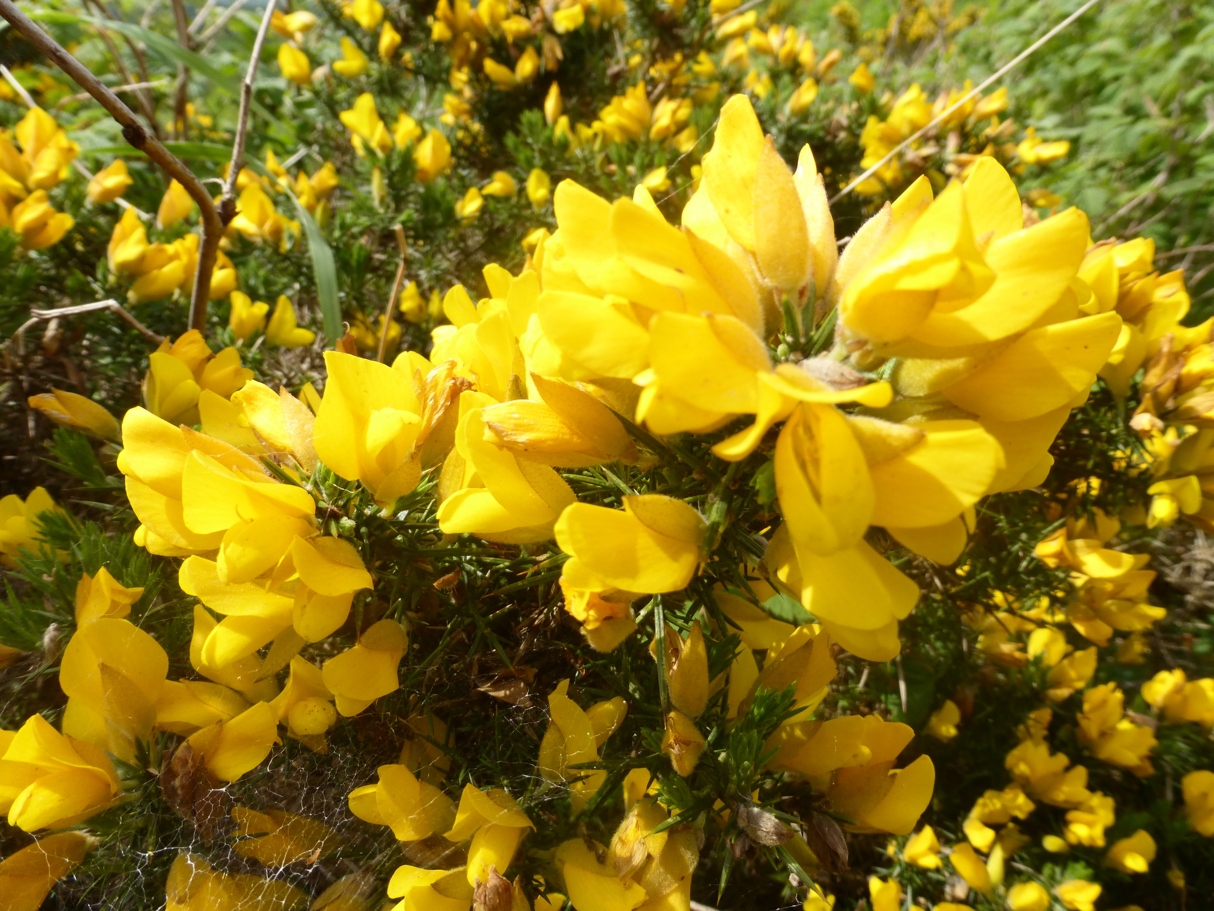
The trail leaves Peebles to the north and follows a pleasant track, rising gradually over grassy hills and paths lined by yellow flowered gorse bushes and thickets of old pine trees. Dry stone walls are a common feature by this stage, outlining farmland boundaries along the way. A number of 'Tweed Trails' signposts mark the way through this stage as the route uses a range of country roads, fields, farm tracks and old drove roads. This area is rich with farmland and the trail does well to weave its way through fields and farm buildings. The trail makes its way through the peaceful forests and grasslands of the Cloich Hills before reaching the small village of Romanno Bridge. From here, the route to West Linton again travels through a series of farmers fields and a final climb up and over Broomlee Hill.
STAGE 5: WEST LINTON TO HARPERRIG
DISTANCE: 8.15 MILES / 13.07 KM
HIGHEST POINT: 430 METRES
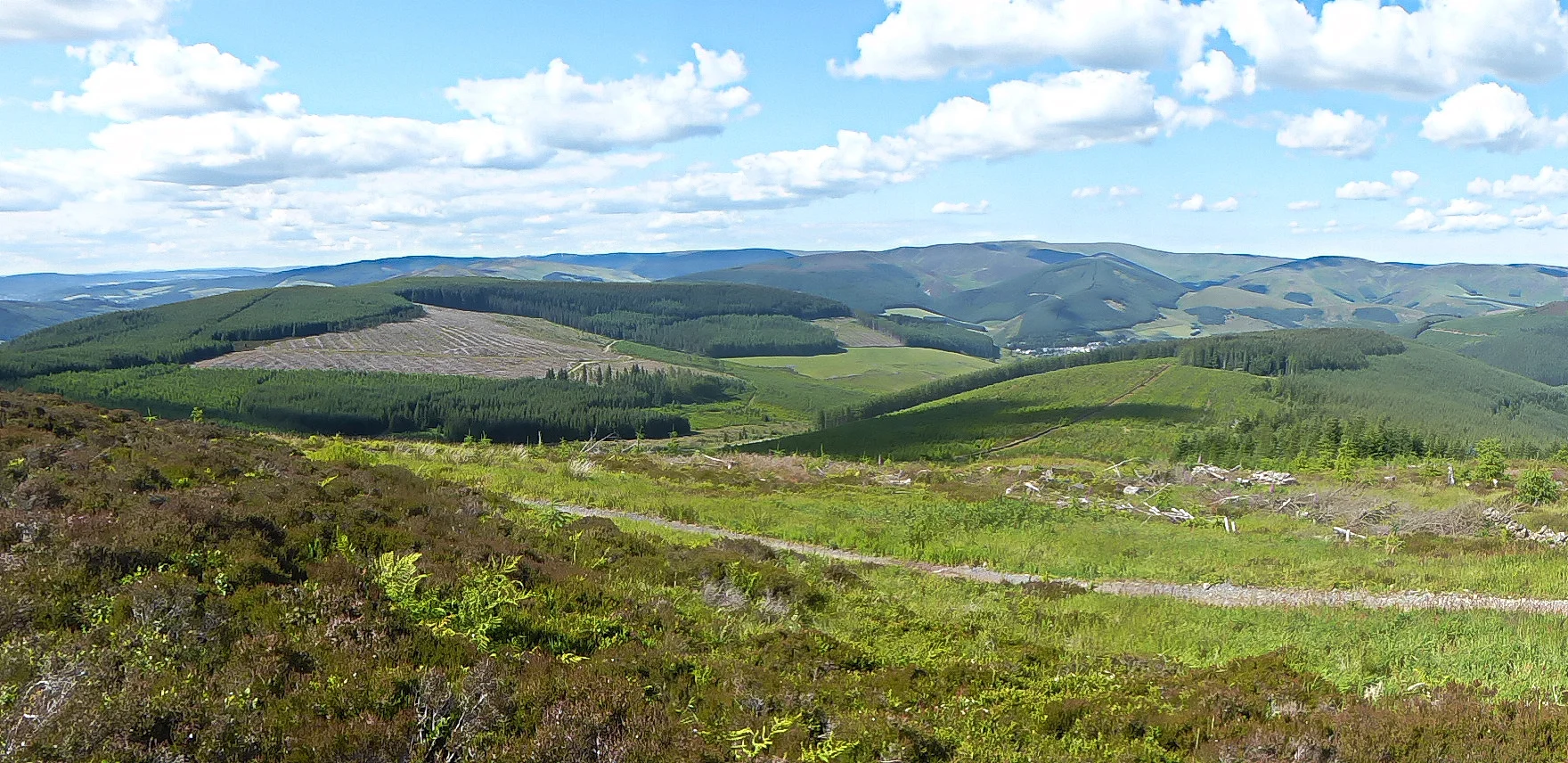
The trail quickly climbs out and away from West Linton, briefly following the course of an old Roman road before heading through Stonypath Farm and onto the wide open hillside. The path gradually climbs the south side of the Pentland Hills, offering beautiful views across to the Tinto Hills and beyond. The path follows around the contours of Faw Mount and the gently flowing Lyne Water - a beautiful little hidden valley. After reaching Baddinsgill Farm, the trail moves onto a wider track, passing the reservoir, resident Highland Cattle and onto the wide expanse of the heather strewn Pentland Hills. The trail reaches the stage highest point, The Cauldstane Slap, where it descends towards Harperrig and the car park at Little Vantage, marking the end of the official Cross Borders Drove Road.
STAGE 6: HARPERRIG TO WEST LOTHIAN & EDINBURGH
DISTANCE: 6+ MILES / 10+ KM
From the car park at Little Vantage, just beyond Harperrig, the route can be tailored to meet your own requirements.
West Lothian - the route continues north over Corston Hill towards Kirknewton, East & Mid Calder and Livingston.
Edinburgh - options include, continuing across the Pentland Hills to Balerno, following the Water of Leith into the heart of Edinburgh, or heading north into West Lothian and the Union Canal, which also leads into the city centre.
Alternatively, walkers can arrange to be collected or transferred to their next destination from the Little Vantage car park.
PRICES & USEFUL INFORMATION
| Tour Code | Walking Days/Nights | Ave. Miles Per Day | Price Per Person ** |
| DROVE1 | 3 Days/4 Nights | 16.86 | £237 - £280 |
| DROVE2 | 3 Days/4 Nights | 16.86 | £235 - £260 |
| DROVE3 | 4 Days/5 Nights | 12.66 | £275 - £320 |
| DROVE4 | 5 Days/6 Nights | 11.75 | £365 - £420 |
| DROVE5 | 5 Days/6 Nights | 13.63 | £348 - £450 |
What is Included?
- Pre-booked Accommodation
- OS Explorer Maps
- Detailed route description
- Full breakfast each morning
- Baggage Transfers
- Daily Itineraries
- Info on transport and local services
What is not included?
Evening meals & packed lunches
Travel to Hawick
Travel from Edinburgh
Travel Insurance
ADDITIONAL INFORMATION
**Prices are based on 2 people sharing a twin or double room.
Please note an additional ‘single room supplement’ or 'single occupancy' charge of £15 per night will be incurred for solo walkers or for individuals who require single room accommodation.
A number of hotels and bed and breakfast can be found along the Cross Borders Drove Road; all with their own unique feel and character. All of our specially selected hotels/B&B's offer breakfast. Individual preferences can be stipulated in the Holiday Booking Form.
This package includes a one night stay in Hawick, before the start of the walk and, depending on how customers wish to tailor the end of the walk, accommodation can be arranged in West Lothian or the Edinburgh area. We can also arrange for transfers from Harperrig to Edinburgh if customers prefer not to extend the walk past the official Drove Road. Details of public transport services are available on request.
If you would prefer to walk the Cross Borders Drove Road using an alternative itinerary, please let us know using the Enquiry Form and we will do our utmost to tailor the holiday to your needs.
Extra Nights & Single Supplements
Many walkers decide to take rest days during their walking holiday, whether to give the feet a well-earned break or to do a little sight-seeing. If this option is of interest to you, please let us know on the booking form. Additional nights can be arranged from £40 per person per night
For solo walkers (party of 1), a single supplement of £15 per night will be incurred. This is to cover the costs of hotels providing single occupancy for a double or twin room.
Accommodation
Each Hotel and Bed & Breakfast has been hand-picked to ensure you enjoy the most welcoming, comfortable and value-for-money experience on this route. A warm welcome awaits all walkers and hikers, with hotel owners keen to hear stories of the day’s adventures. Evening meals and packed lunches for the onward journey are available on request, however, please note that they are NOT included in the holiday package.
Baggage Transfer
There is no single dedicated baggage transfer service along the Cross Borders Drove Road, however, we will arrange for local transport operators and hoteliers to provide an equivalent service, ensuring your heavier bags will be transferred and delivered safely to your next place of accommodation.
Navigation
The route is well signposted throughout, however, walkers must be vigilant at all times as there are paths and junctions along the way which deviate from the main route. The Drove Road follows a number of routes, including the Southern Upland Way, Borders Abbey Way and Tweed Trails. As well as our route guide, your package includes detailed Ordnance Survey maps of the entire route. WAS highly recommend that at least one member of your party is a competent map and compass reader.
Transport & Travel
Although travel to Hawick, and from the area around Harperrig (including Edinburgh), is not included in the holiday package, we are more than happy to provide details of public transport services. We may also be able to offer transfers from the finish point to nearby public transport services.
- To Hawick – There is a reliable and frequent bus service from Edinburgh, allowing easy access from anywhere in the UK and overseas.
- From Edinburgh/West Lothian – Public transport, by train, bus or taxi.
Transport links will be detailed in your holiday package information pack.
Travel Insurance
WAS highly recommends that all walkers have suitable travel insurance.
Minimum Group Size
This route is suitable for solo walkers
Enjoying Scotland Responsibly
The Scottish Outdoor Access Code is a set of guidelines issued by The Scottish National Heritage Trust. The Scottish Outdoor Access Code provides detailed guidance on the responsibilities of those exercising access rights and of those managing land and water. By doing so, the Code provides a practical guide to helping everyone make informed decisions about what best to do in everyday situations.
Each holiday information pack will include a copy of the Outdoor Access Code Summary Leaflet, including details of where the full code and A-Z guide can be downloaded.
ITINERARIES
| DROVE1 | 3 DAYS/4 NIGHTS | DISTANCE |
| Night 1 | Hawick | n/a |
| Day 1/Night 2 | Hawick to Selkirk | 10.80 miles / 17.30 km |
| Day 2/Night 3 | Selkirk to Peebles | 19.60 miles / 30.30 km |
| Day 3/Night 4 | Peebles to Harperrig | 21.03 miles / 33.80 km |
| DROVE3 | 4 DAYS/5 NIGHTS | DISTANCE |
| Night 1 | Hawick | n/a |
| Day 1/Night 2 | Hawick to Selkirk | 10.80 miles / 17.30 km |
| Day 2/Night 3 | Selkirk to Peebles | 19.60 miles / 30.30 km |
| Day 3/Night 4 | Peebles to West Linton | 12.88 miles / 20.73 km |
| Day 4/Night 5 | West Linton to Harperrig | 8.15 miles / 13.07 km |
| DROVE5 | 5 DAYS/6 NIGHTS | DISTANCE |
| Night 1 | Hawick | n/a |
| Day 1/Night 2 | Hawick to Selkirk | 10.80 miles / 17.30 km |
| Day 2/Night 3 | Selkirk to Peebles | 18.80 miles / 30.30 km |
| Day 3/Night 4 | Peebles to West Linton | 12.88 miles / 20.73 km |
| Day 4/Night 5 | West Linton to W. Lothian | 13.15 miles / 21.04 km |
| Day 5/Night 6 | W. Lothian to Edinburgh | 12.50 miles / 20.00 km |
| DROVE2 | 3 DAYS/4 NIGHTS | DISTANCE |
| Night 1 | Hawick | n/a |
| Day 1/Night 2 | Hawick to Traquair | 20.60 miles / 33.10 km |
| Day 2/Night 3 | Traquair to West Linton | 21.88 miles / 35.23 km |
| Day 3/Night 4 | West Linton to Harperrig | 8.15 miles / 13.07 km |
| DROVE4 | 5 DAYS/6 NIGHTS | DISTANCE |
| Night 1 | Hawick | n/a |
| Day 1/Night 2 | Hawick to Selkirk | 10.80 miles / 17.30 km |
| Day 2/Night 3 | Selkirk to Traquair | 9.80 miles / 15.80 km |
| Day 3/Night 4 | Traquair to Peebles | 9.00 miles / 14.50 km |
| Day 4/Night 5 | Peebles to West Linton | 12.88 miles / 20.73 km |
| Day 5/Night 6 | West Linton to W. Lothian | 16.25 miles / 26.00 km |
Gallery